Recently, anyone frequenting a bus stop in Changwon will have noticed that the bus route maps have been removed. Addtionally, many bus numbers have been changed or removed. This was caused by the city updating the bus system to fold in Jinhae and Masan’s buses.
Normally, the easiest (computer/smart phone-aided) way to check a bus stop’s servicing buses would be to check Daum’s mapping system. While this is still an easy way to find out about a bus stop (just zoom in and click a stop to be provided with the stop’s name, street view, and bus numbers), it is Korean and thus, requires experimentation for the uninitiated. Here is a great resource for leaning how to use Daum maps. Really. It will change the way you travel in Korea.
Saving the day is Changwon’s official website, which recently made available an enourmous, downloadable PDF, featuring individual maps of over 80 bus routes. To view the maps as an ebook, click here. To download all on the maps, follow the same link and click the long, blue button on the top, middle saying “원본파일 다운받기”.
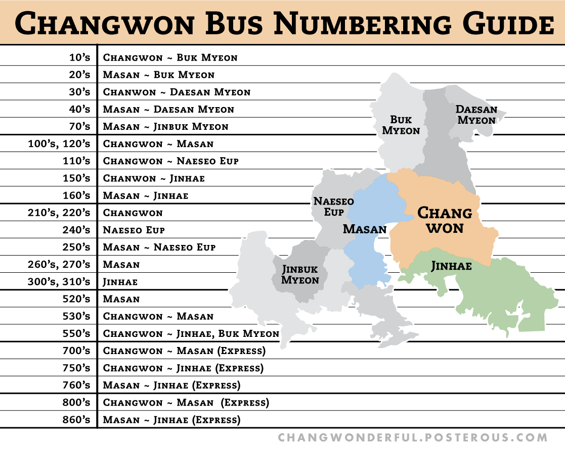
Using these maps as a guide, here’s a general guide to the meanings of each bus number.
 Changwonderful


